California’s warm spell is ending as rain, snow enter forecast
San Francisco Chronicle • • nation
Key Points:
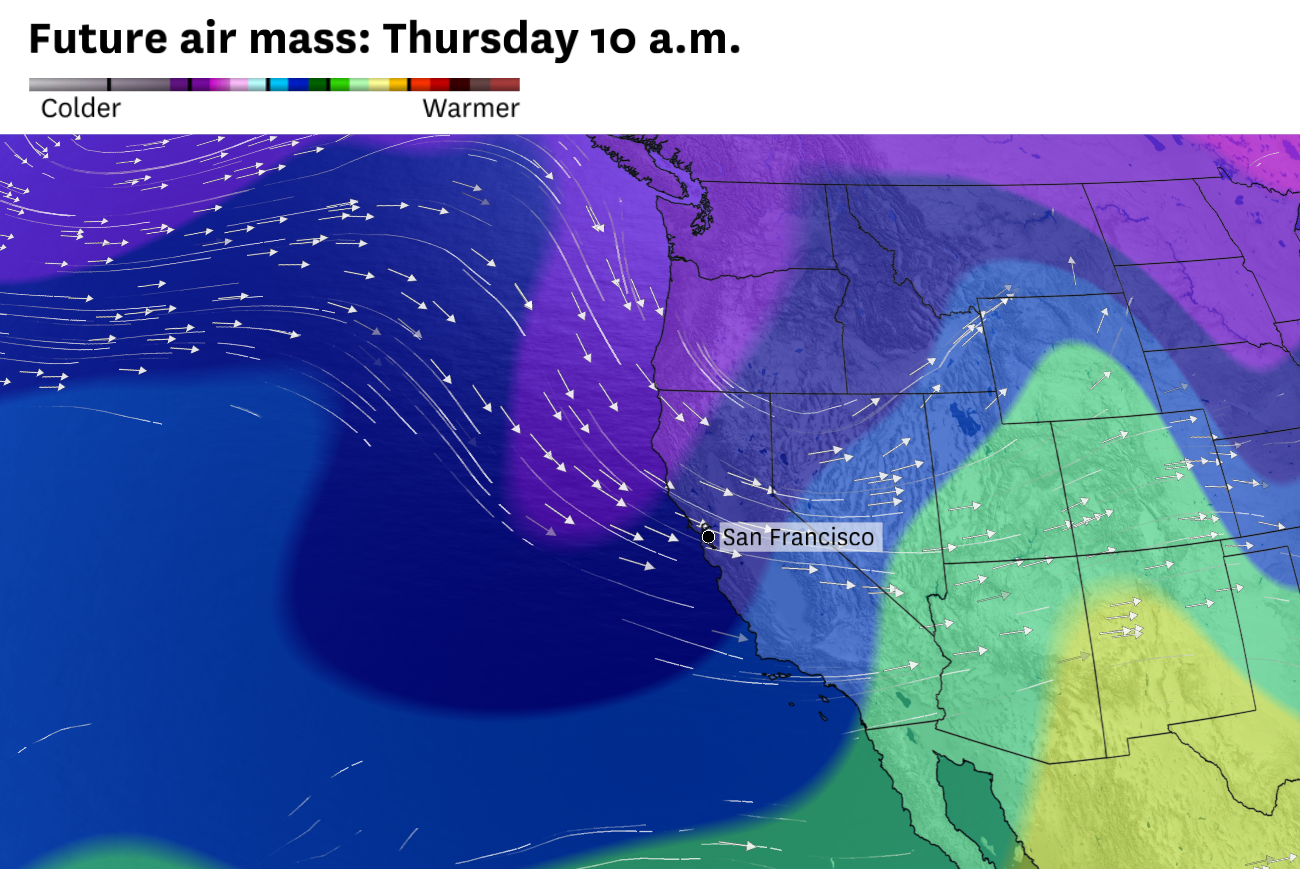
- California's prolonged March heatwave is ending as a high-pressure system weakens and shifts eastward, allowing cooler, wetter Pacific air to enter the state starting Tuesday.
- Temperatures will normalize Tuesday and drop below seasonal averages by midweek, with highs in the 60s in the Bay Area and Sacramento Valley and nighttime lows below freezing in the Sierra Nevada.
- While earlier forecasts suggested widespread rain, current models predict only light precipitation, mainly drizzle in major cities like San Francisco and Los Angeles, with the Central Coast and some Central Valley areas seeing the best chance for measurable rain.
- A more organized low-pressure system may bring moderate rain to Northern California from Wednesday evening through Thursday morning, along with the northern Sierra receiving up to half a foot of snow, refreshing ski slopes before the season ends.
- Dry and warm weather is expected to return by Friday, with widespread 80-degree temperatures forecast for the first weekend of April.


